# How to Draw a Road
Most properties already show the adjacent road clearly in the satellite image, which is enough to generate your right-of-way line directly. This tool is for the cases where that's not true — an unpaved road, a private drive, or a proposed road that doesn't exist on the imagery yet.
Quick Answer
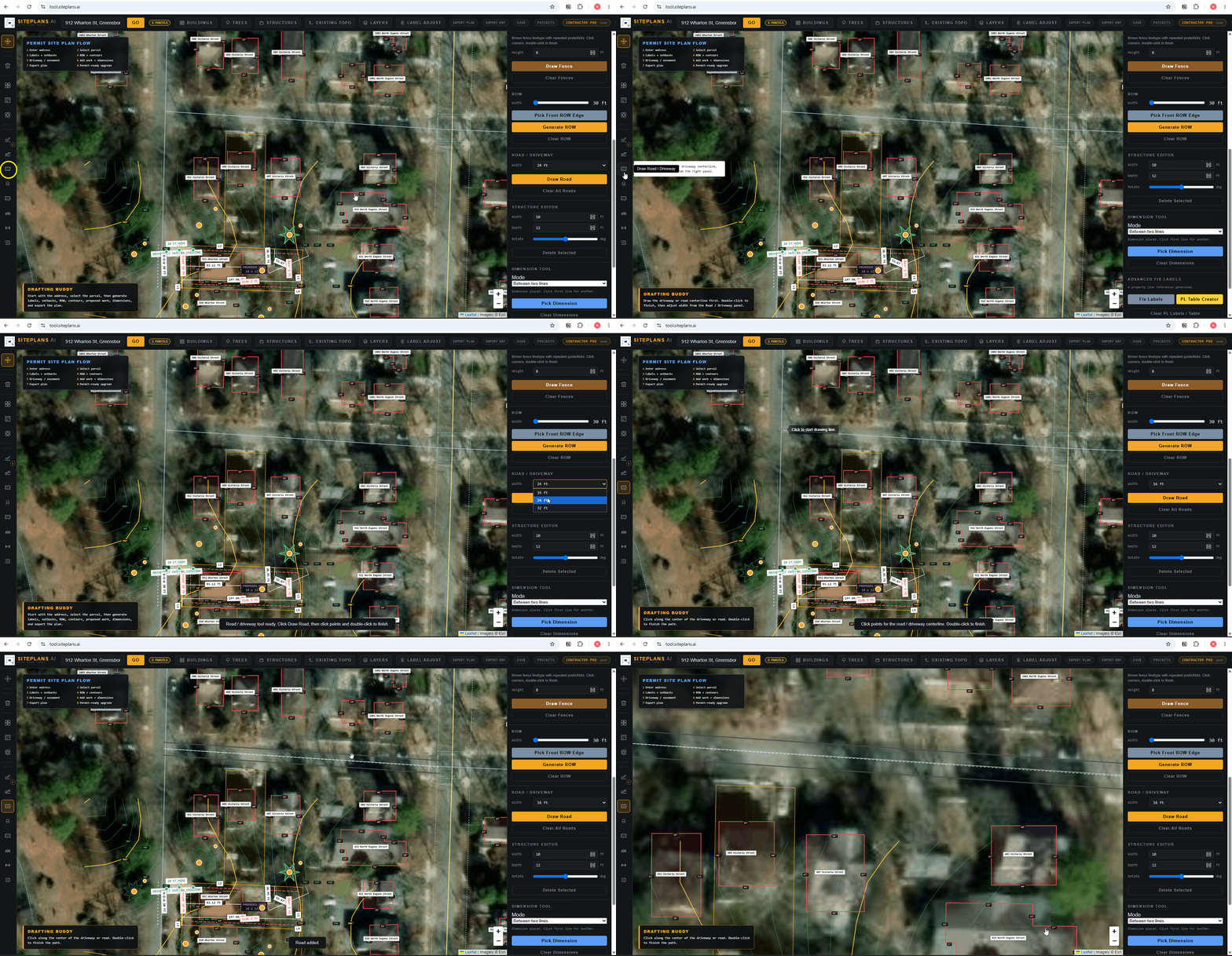
Select the road tool, click your starting point along where the road runs, and trace its path — adding turns as needed — clicking again to finish. Use this before generating right-of-way if your road isn't clearly visible in the aerial view.
Step-by-Step
1. Select the road tool from the toolbox.
2. Click your starting point where the road begins relative to your property.
3. Trace the path, clicking at any bends or turns.
4. Click to finish the road line.
5. Generate your right-of-way from this line the same way you would from a clearly visible road — see how to generate right-of-way.
When to Use This
Only when the road adjacent to your property isn't clean or visible enough in the satellite image to pick a front line directly — unpaved roads, private access roads, or a proposed road on a subdivision that doesn't exist in imagery yet.
Common Mistakes
Using this when it's not needed. If your road is clearly visible in the aerial view, skip this and pick your front line directly when generating setbacks and right-of-way.
Tracing an approximate path instead of checking it against any available reference — county GIS records or a recent survey, if you have one.
FAQ
Do I need this for every project?
No — most properties have a clean, visible road in the satellite imagery, so you can skip straight to picking your front line for setbacks and right-of-way.
What if my road doesn't exist yet — a new subdivision?
Trace the proposed path based on your development plans or plat, and note in your title sheet that this is a proposed road.
Related Tools
Start Here
Create My Site Plan — Need help? Get support from SitePlans.us →