The Short Answer
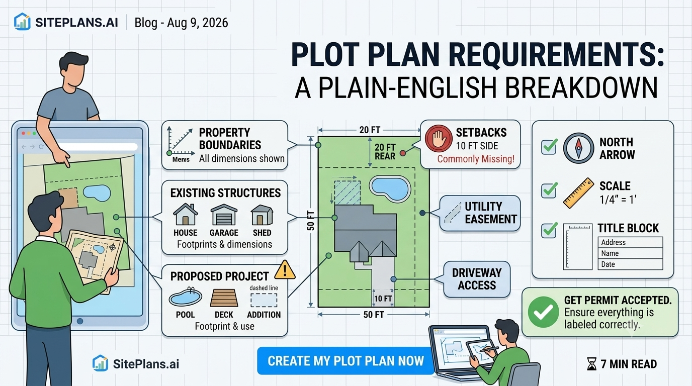
A plot plan must show property boundaries with dimensions, existing structures, proposed structures, setbacks from property lines, easements, and a title block with your address, name, and date. Missing any of these can get your application rejected.
What Is a Plot Plan?
A plot plan (sometimes called a site plan) is a scaled, top-down drawing of your property that shows:
- Where your property boundaries are
- What's already built on the property
- What you're proposing to build
- How far everything is from the property lines
Building departments use plot plans to verify that your project complies with local zoning codes, setback requirements, and land use regulations.
What Building Departments Require on a Plot Plan
Based on official city checklists, a plot plan must include:
1. Property Boundaries
- All property lines with accurate dimensions
- The lot's total square footage
- The Assessor's Parcel Number (APN) if required by your city
2. Existing Structures
- House, garage, sheds, pools, and other structures
- Their footprints and dimensions
3. Proposed Structures
- Clearly distinguished from existing structures
- Footprint, dimensions, and intended use
- This is the most common missing element on rejected plans
4. Setbacks
- Distances from structures to property lines
- Front yard, rear yard, and side yard setbacks
- Missing setbacks are the #1 reason plots get rejected
5. Easements
- Utility, drainage, and access easements
- Their dimensions and locations
6. Driveways and Access
- Driveway location and dimensions
- Parking spaces (if required)
7. North Arrow and Scale
- North arrow for orientation
- Scale bar (e.g., 1/4" = 1')
8. Title Block
- Address
- Owner name and contact information
- Project description
- Date
Plot Plan vs. Site Plan: Same Thing
The terms "plot plan" and "site plan" are used interchangeably by most building departments. Some cities use one term; others use the other. Both refer to the same drawing.
What Gets Plot Plans Rejected
| Mistake | What to Do Instead |
|---|---|
| No property lines shown | Always show all property boundaries with dimensions |
| No setbacks | Show distances from structures to property lines |
| Missing proposed structures | Clearly distinguish existing vs. proposed |
| No scale or north arrow | Every plan needs scale and orientation |
| No title block | Include address, owner name, project description, and date |
| Wrong scale | Check your city's required scale (usually 1/4" = 1' or 1/8" = 1') |
| No easements shown | Utility and drainage easements must be shown |
How to Create a Plot Plan Without CAD
You don't need expensive software or a drafter. Our site plan creator webtool lets you:
- Enter your address — see your property lines
- Add your proposed project
- Label setbacks and dimensions
- Export a clean, permit-ready PDF
It's free for your first plan — no CAD required.
FAQ
Q: What is the difference between a plot plan and a survey?
A: A plot plan is a drawing showing property lines, structures, and proposed work. A survey is a legal document prepared by a licensed surveyor that establishes official property boundaries. Most small residential permits only need a plot plan, not a full survey.
Q: Can I draw my own plot plan?
A: Yes, in most cities. Many building departments accept homeowner-prepared plot plans for small residential projects. Check with your local building department.
Q: What scale should my plot plan be?
A: Most cities require 1/4" = 1' or 1/8" = 1'. Check your city's specific requirements.
Q: Do I need a survey for a plot plan?
A: Not usually. A plot plan can be created from public records, GIS data, and satellite imagery. Some cities require a certified survey for certain projects.
Q: What if my city rejects my plot plan?
A: You can revise it yourself or order a done-for-you plan from SitePlans.us (non-certified, permit-ready only).