# How to Enter a Property Address in SitePlans.ai
Nothing else in SitePlans.ai works until you enter an address first. Once you do, your parcel loads automatically with property lines, bearings, and distances already in place — no clicking around the map required. Here's how to get it right.
Quick Answer
Type your full address into the search bar at the top of the page and press Enter or click Go. Your parcel will be found and selected automatically, and property lines will appear with bearing and distance labels.
Before You Start
You don't need an account to try this. Anyone can search an address and look around. But if you want to save your project and come back to it later, create a free account first — otherwise your work won't persist between sessions.
Step-by-Step: Entering Your Address
1. Go to SitePlans.ai
Open SitePlans.ai in your browser.
2. Find the search bar
It's at the top of the page, with placeholder text reading "Enter property address" and a Go button beside it. It's visible whether you're on the homepage or already inside the site plan creator.
3. Type the full address
Include the street number, street name, city, and state. ZIP code isn't required but helps narrow the search.
Example: `123 Main Street, Atlanta, GA`
If the address doesn't come up right away, try spelling out the street type ("Street" instead of "St"), or add the ZIP code.
4. Press Enter or click Go
This starts the search.
5. Let the parcel load
The map will zoom to your property and select the parcel automatically. You don't need to click anything on the map yourself.
6. Check your property lines
Once loaded, you'll see:
- Property lines drawn on the map
- Bearing and distance labels on each boundary line
- Neighboring parcels shown for context, where that data is available
Those bearing and distance labels are exactly what a permit reviewer expects to see on a site plan — they show you the direction and length of every property line.
If Your Lot Has an Irregular Shape
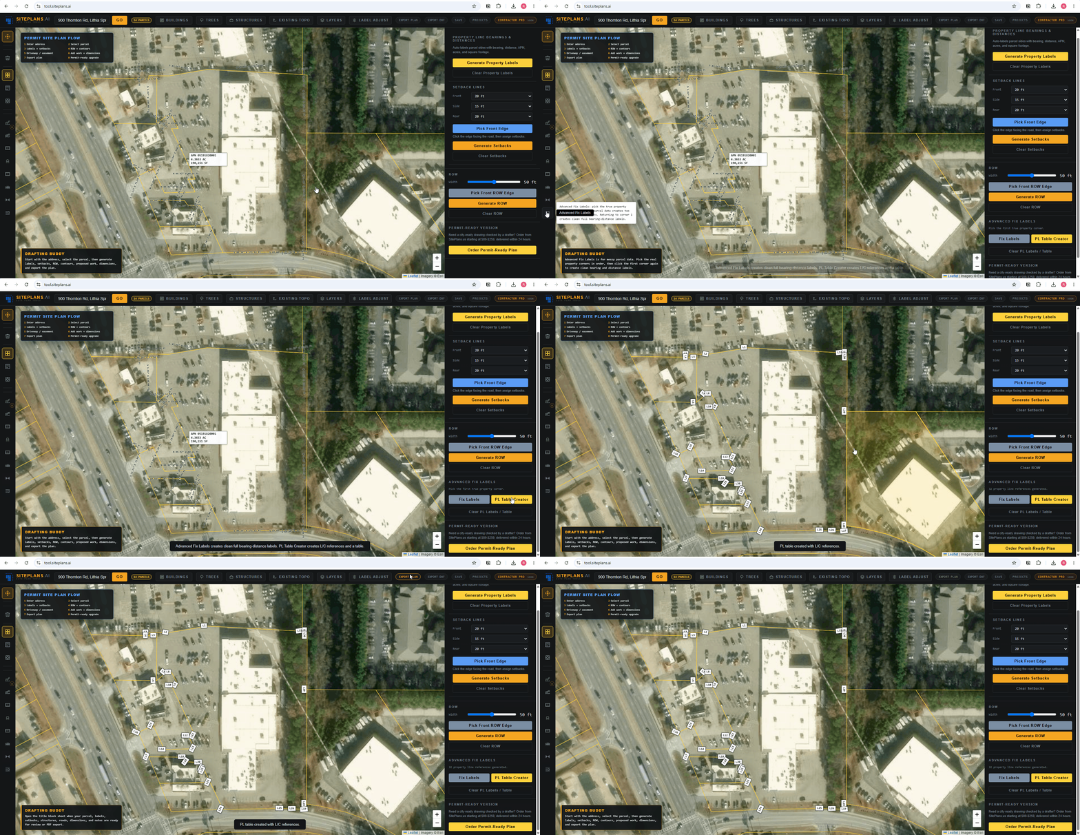
Larger lots, commercial parcels, or properties with a lot of corners can end up with crowded, overlapping labels. There's a cleaner way to handle it:
- Open the Clean Label tool
- Select Create PL Table
- SitePlans.ai will generate a table of all your property line data — bearings and distances — and place it directly in your title block sheet
Once the table's created, click Move to drag it into position, or resize it so it fits cleanly on your sheet. This is worth doing any time individual line labels start feeling cluttered on the map itself.
What to Check Before You Keep Going
- The address matches your actual property
- The parcel is selected and highlighted on the map
- Bearing and distance labels are visible on the property lines
- If your lot is irregular: the PL Table is generated and positioned where you want it
- Everything in the title block reflects the right address and project info
A Note on Coverage
SitePlans.ai works best where county property-line data is strong, and that varies by location. Some areas show clean, precise boundaries. Others start from broader public data that may need a second look. If your property lines don't look right once they load, that's worth checking against your county assessor or GIS records before you build the rest of your plan on top of them.
You can check the coverage page to see how well-supported your area currently is.
Common Mistakes
Typing just the street number, no city or state. You'll get better results including the full address.
Not pressing Enter or clicking Go. The search doesn't run until you do one or the other.
Assuming the parcel didn't load when it just needs a second. Give the map a moment to zoom and populate before assuming something's wrong.
Skipping the coverage check. If you're in an area with limited data, it helps to know that going in rather than after you've built out a full plan.
If Something Isn't Working
Address won't show up — Try a different format: spell out "Street" instead of abbreviating it, or add your ZIP code. Very new or recently subdivided properties may not be in the system yet.
Parcel isn't selected — Click directly on the parcel on the map to select it manually.
Property lines look off — Cross-check against your county assessor's site or local GIS records. Data quality varies by area.
No labels are showing — Try zooming in or out; labels sometimes appear only at certain zoom levels. For a larger or more complex lot, use the Clean Label tool to generate a PL Table instead.
Map won't load at all — Refresh the page, check your connection, or try a different browser.
When to Get Help
Reach out to SitePlans.ai support or use the done-for-you option from SitePlans.us if:
- Your address won't load no matter what you try
- The property lines look clearly wrong or incomplete
- You're in a floodplain and need certified elevation data
- Your city requires a licensed surveyor or stamped plans
- Your permit was already rejected and you want a professional to take it from here
- You need a permit-ready plan fast
Related SitePlans.ai Tools
- Create your site plan from an address
- SitePlans.ai coverage areas
- How to add structures to your site plan
- How to export your site plan PDF
- SitePlans.ai support center
FAQ
Do I need to sign in to enter an address?
No. You can search an address and explore without an account. Create a free one if you want to save your project and pick it back up later.
What if my address won't load?
Try a different format — spell out the street type, or add your ZIP code. If the property is brand new or recently subdivided, it might not be in the system yet. Support can help if it still doesn't turn up.
Why do I see two properties on the map?
SitePlans.ai shows neighboring parcels for context. Your property is the one that's highlighted and selected.
What do the numbers and letters on the property lines mean?
Those are bearings and distances — the direction and length of each boundary line. It's standard information for a permit-style site plan.
My lot has an odd shape. What should I do?
Use the Clean Label tool and select Create PL Table. It'll generate a clean table of all your bearings and distances and drop it into your title block, which you can then move or resize as needed.
Can I edit the property lines myself?
No — they're pulled from county parcel data. If something looks wrong, check it against your county assessor or GIS records rather than adjusting it manually in the tool.
How do I know if my area has good coverage?
Check the Your City In Coverage. Coverage is expanding regularly, but quality still varies by location.
Will my project save automatically?
Only if you've created a free account. Otherwise, your work won't persist once you close the tab.
What if my city wants a licensed survey instead of a site plan?
Some jurisdictions require a sealed survey for certain project types. SitePlans.ai is built for preliminary, permit-style site plans where local rules allow homeowner or contractor-prepared drawings — always confirm what your specific city requires before you submit.
Does this work for commercial properties?
Yes. The Clean Label and PL Table tools are especially useful for larger commercial or industrial lots with more complex boundary shapes.
Start Here
Type in your address and see your property lines in seconds.
Need help with a tricky property or a rejected permit?